It’s hot enough to break records! South China welcomes the hottest day in the history of May, and the high temperature and heat will continue.
It’s really hot! According to the temperature map at 14 o’clock this afternoon, the south is really hot.
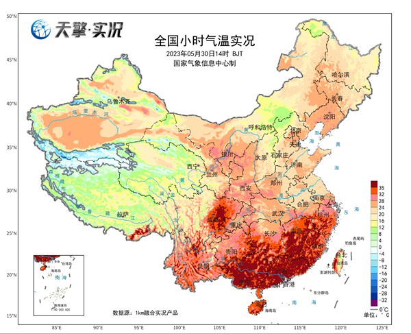
↑ Today (May 30) at 13: 55 pm, the temperature in Guangzhou soared to 38 C, welcoming the earliest 38 C in history.
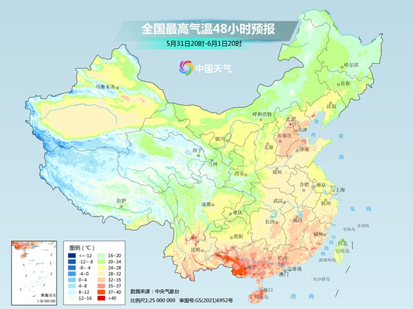
Compared with yesterday, today’s high-temperature "firepower" is concentrated in the Sichuan Basin and South China. As of 14: 00, a wide range of high temperature weather occurred in Sichuan Basin, central Yunnan, Guangxi, Guangdong, Fujian, southern Hunan, eastern and southern Jiangxi, and southern Zhejiang this afternoon.
Especially in most parts of Guangdong, southwestern Jiangxi and southern Fujian, there is high temperature above 37℃. Including Guangzhou, Xinhui, Pingyuan, Yangjiang, Qingyuan, Kaiping, Huadu and Dongguan in Guangdong, all broke the historical extreme high temperature in May.
As the weather situation adjusts, we need to pay attention to the following changes in the next few days ↓
First, the high temperature in the south of the Yangtze River relieves the sweltering heat.
The main reason why the high temperature center moves southward is that the subtropical high pressure system will move eastward and southward today, and the high temperature in the south of the Yangtze River will gradually decrease. In the next few days, the highest temperature in many places in the south of the Yangtze River will still be above 30℃, and the lowest temperature at night will be around 25℃. Coupled with the high relative humidity, it is difficult to obviously alleviate the sultry feeling.
Second, the peak period of high temperature in South China has come one after another.
For South China, the high temperature has entered a white-hot stage.
In addition to the subtropical high pressure system overhead, which brings sunny weather and intense radiation warming, to make matters worse, there is a "wandering" typhoon "Mawa" not far from the east of Taiwan Province.
Because the typhoon itself is not weak, it is not far away. The most significant subsidence and warming effect on the periphery of the typhoon just covered Guangdong, Fujian and other places, so it is estimated that the historical record of high temperature in these two days in May will be refreshed in large numbers.
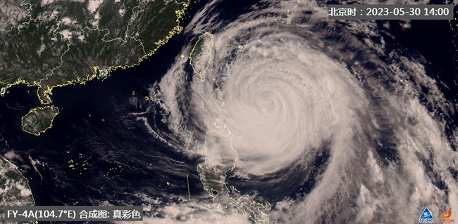
More "unlucky" is that since last night, with the gradual rupture of the subtropical high belt, steering flow has weakened and Mawa has obviously slowed down. In the next few days, "Mawa" is still in the saddle-shaped field between the east and west ring high pressure, and its moving speed is still slow.
A slow typhoon means that this "air conditioner" in South China will have to blow for several more days, and the hot weather will continue.
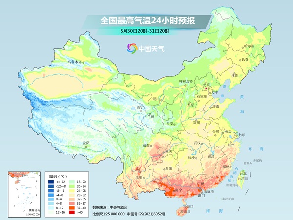
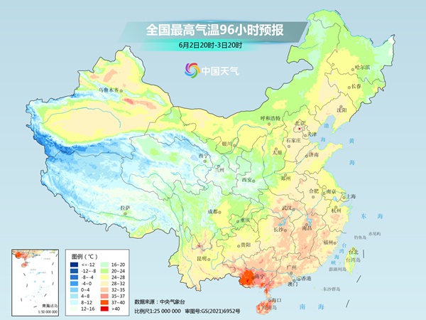
It is estimated that in the next three days, most of South China, most of the south of the Yangtze River, southern Guizhou, northern and southern Yunnan, southern Sichuan and other places will have high temperature above 35℃, with some areas reaching 37~39℃ and local 40℃. In particular, Guangdong, Fujian and other places will be one of the hottest regions in China.
Fuzhou, for example, has forecast continuous high temperature in the next few days, and it may even reach 40℃ on June 1, or break the extreme value of the highest temperature in June since the local meteorological record.
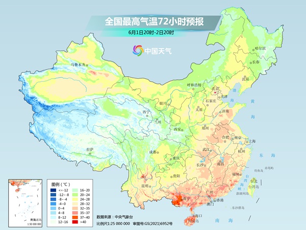
It is worth mentioning that the high temperature in Guangxi is also very prominent in the next few days, especially after the peak period of high temperature in Guangdong and Fujian, Guangxi will "relay" to the top, and there will be a large area of high temperature and summer weather above 37 C.
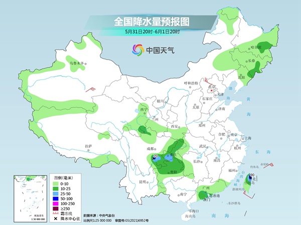
Third, the high temperature in Sichuan Basin will soon be drowned out by rain.
Then there is the Sichuan Basin, which is as hot as a brazier today. The high temperature here won’t last long. There will be rain to cool down this week, and even there is too much rain in some areas, so we should pay attention to prevent heavy rain.
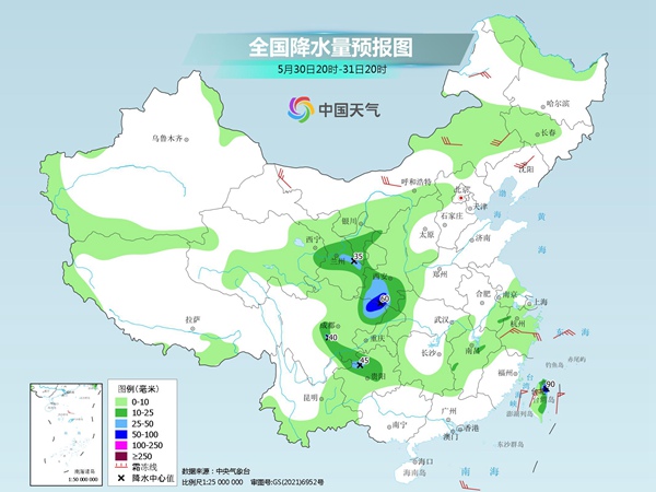
Affected by the intersection of southwest airflow and cold air at the periphery of the subtropical high, there will be continuous rainfall in eastern Sichuan, Chongqing and southwestern Shaanxi in the second half of this week, with accumulated rainfall of 100-200 mm in some areas and more than 200 mm locally. Focus on the large accumulated precipitation in the border area between northeastern Sichuan and Shaanxi, and be wary that precipitation may cause secondary disasters.